> ## Documentation Index
> Fetch the complete documentation index at: https://docs.connectedfleet.michelin.com/llms.txt
> Use this file to discover all available pages before exploring further.
# Location types
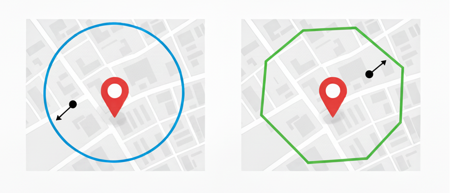
Each Location can be defined using one of two geofence types Radius or Polygon.
 ### Radius
A circular geofence defined from a central point (latitude and longitude) or derived from an address.
* The radius can be set between 0.001 km and 1 km (approximately 3 to 3,280 feet).
* Recommended default: 100 metres (≈328 feet).
* Ideal for simple, evenly shaped areas such as depots, yards, or customer sites.
Use a circular geofence for small, regularly shaped areas to simplify reporting.
### Polygon
A polygonal geofence defined by an ordered array of coordinate pairs.
* Must include at least three latitude and longitude pairs.
* The geofence boundary is automatically closed by linking the first and last coordinate pair.
* Suitable for irregularly shaped areas such as large warehouses, airfields, or industrial estates.
When importing via API, ensure the coordinates are listed in order (clockwise or counter-clockwise) to prevent crossing lines or invalid shapes.
### Radius
A circular geofence defined from a central point (latitude and longitude) or derived from an address.
* The radius can be set between 0.001 km and 1 km (approximately 3 to 3,280 feet).
* Recommended default: 100 metres (≈328 feet).
* Ideal for simple, evenly shaped areas such as depots, yards, or customer sites.
Use a circular geofence for small, regularly shaped areas to simplify reporting.
### Polygon
A polygonal geofence defined by an ordered array of coordinate pairs.
* Must include at least three latitude and longitude pairs.
* The geofence boundary is automatically closed by linking the first and last coordinate pair.
* Suitable for irregularly shaped areas such as large warehouses, airfields, or industrial estates.
When importing via API, ensure the coordinates are listed in order (clockwise or counter-clockwise) to prevent crossing lines or invalid shapes.