> ## Documentation Index
> Fetch the complete documentation index at: https://docs.connectedfleet.michelin.com/llms.txt
> Use this file to discover all available pages before exploring further.
# Location icons
When creating a Location (Point of Interest or POI), it must be assigned to a **Location Category**. You can create as many location categories as needed to match your organisation’s reporting or tracking requirements, for example, Customer Sites, Depots, or Delivery Points.
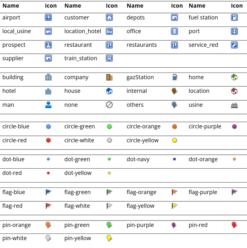
Each **Location Category** can be assigned one of the standard **myConnectedFleet** icons. These icons are displayed on the map within the **myConnectedFleet portal** to help visually distinguish different types of locations.
**Available Icons**
Below is a list of the standard myConnectedFleet icon names that can be used when creating or updating a Location Category via the API.
Choose icons that make your maps easier to interpret, for example, use colour-coded icons to represent customers, depots, or restricted areas.